Data Source
Represents a page with specific parameters that, when specified correctly, connect the workspace to external data sources such as a portal, feature services, maps and feature tables and allows the correct data to be retrieved from that source.
Data Source page is shared between the Manager and the Mobile within one Workspace.
Portals page
Portal is a component of ArcGIS Enterprise that allows to share maps, scenes, apps, and other geographic information with other people in the organization. In other words, a platform for creating, analyzing, managing, and sharing geographic information.
Actions on the Portals page:
Add a Portal
Search a Portal in the list of portals
Edit an existing Portal
Delete a Portal
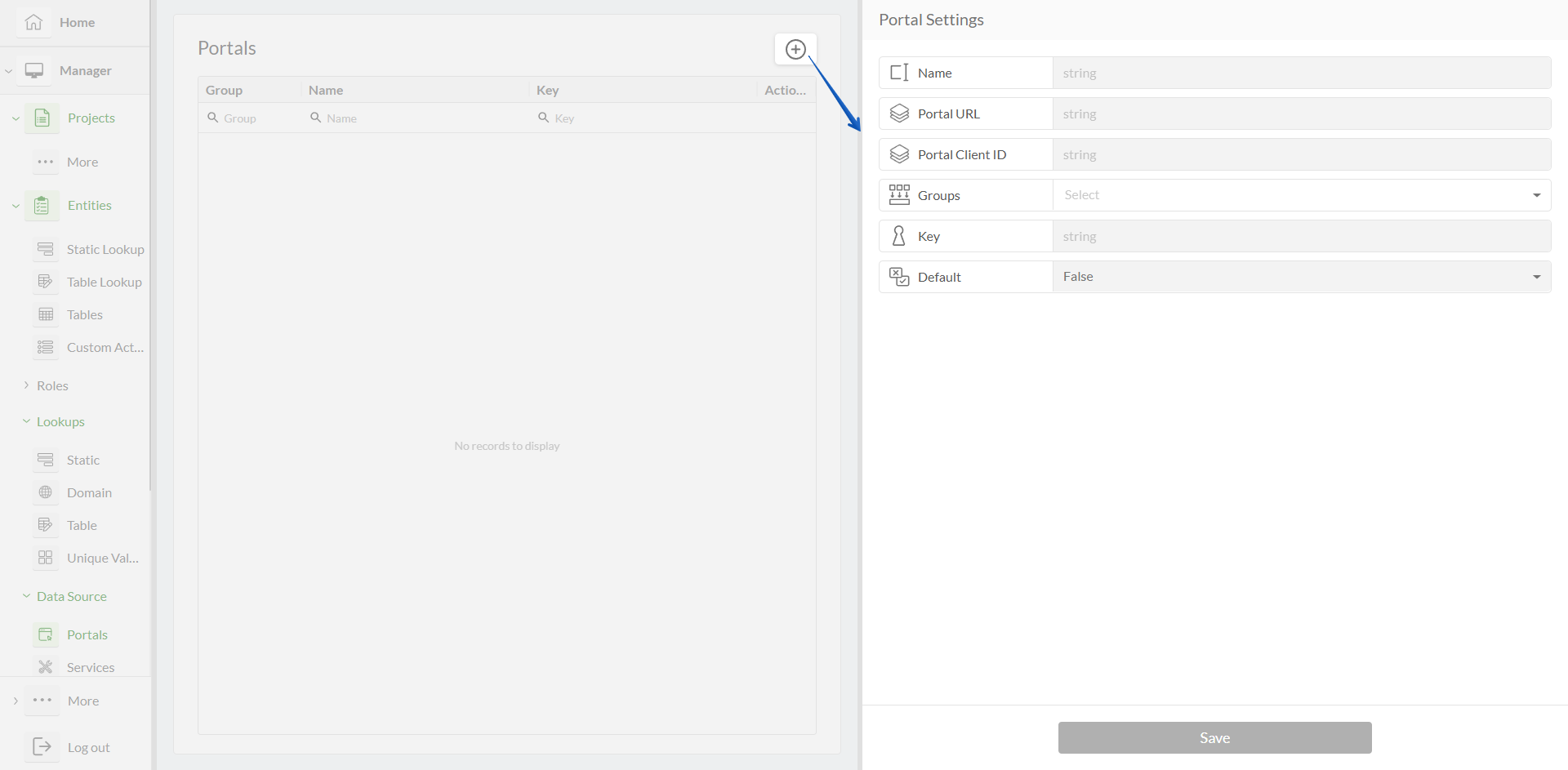
Portal Settings
Option | Required? | Description | Visualization |
|---|---|---|---|
Name | Yes |
|
|
Key | Yes |
| |
Group | Yes |
| |
Portal URL | Yes |
| |
Portal Client ID | Yes |
|
Services page
Service (Feature Service) is a type of web service that allows users to access and interact with geographic features and their associated attribute data. Feature services are used to publish and share feature layers, which contain spatial data (such as points, lines, or polygons) along with attribute information describing those features.
Actions on the Services page:
Add a Feature Service
Search a Feature Service in the list of services
Edit an existing Feature Service
Delete a Feature Service
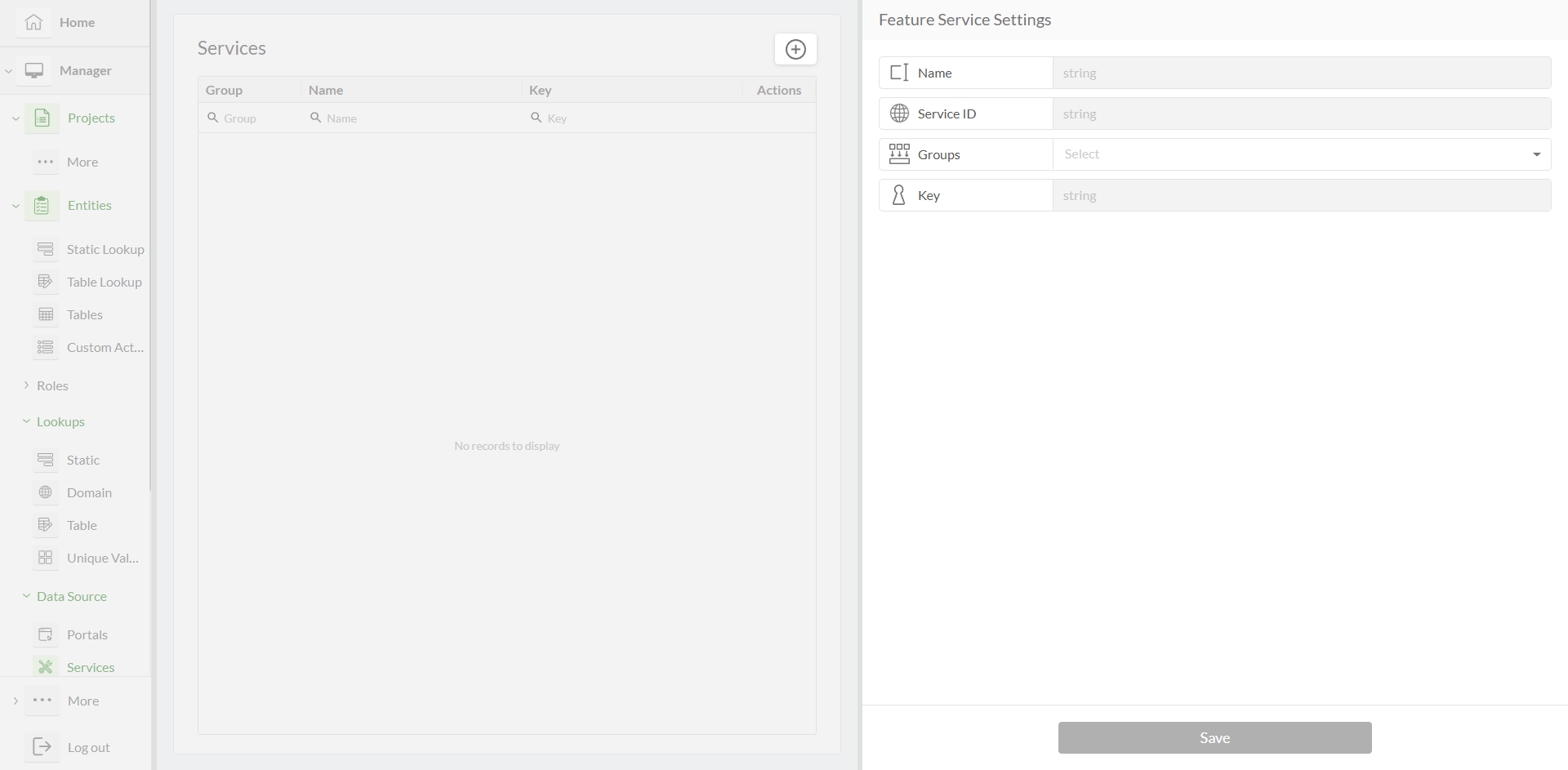
Service Settings
Option | Required? | Description | Visualization |
|---|---|---|---|
Name | Yes |
|
|
Key | Yes |
| |
Group | Yes |
| |
Service ID | Yes |
| |
Portal | Yes |
|
Maps page
Map is a representation of geographic data that is created and viewed within a GIS environment. A map in ArcGIS typically consists of layers of spatial data, including points, lines, polygons, raster images, and other geographic features, along with associated attribute information.
Actions on the Maps page:
Add a Map
Search a Map in the list of maps
Edit an existing Map
Delete a Map
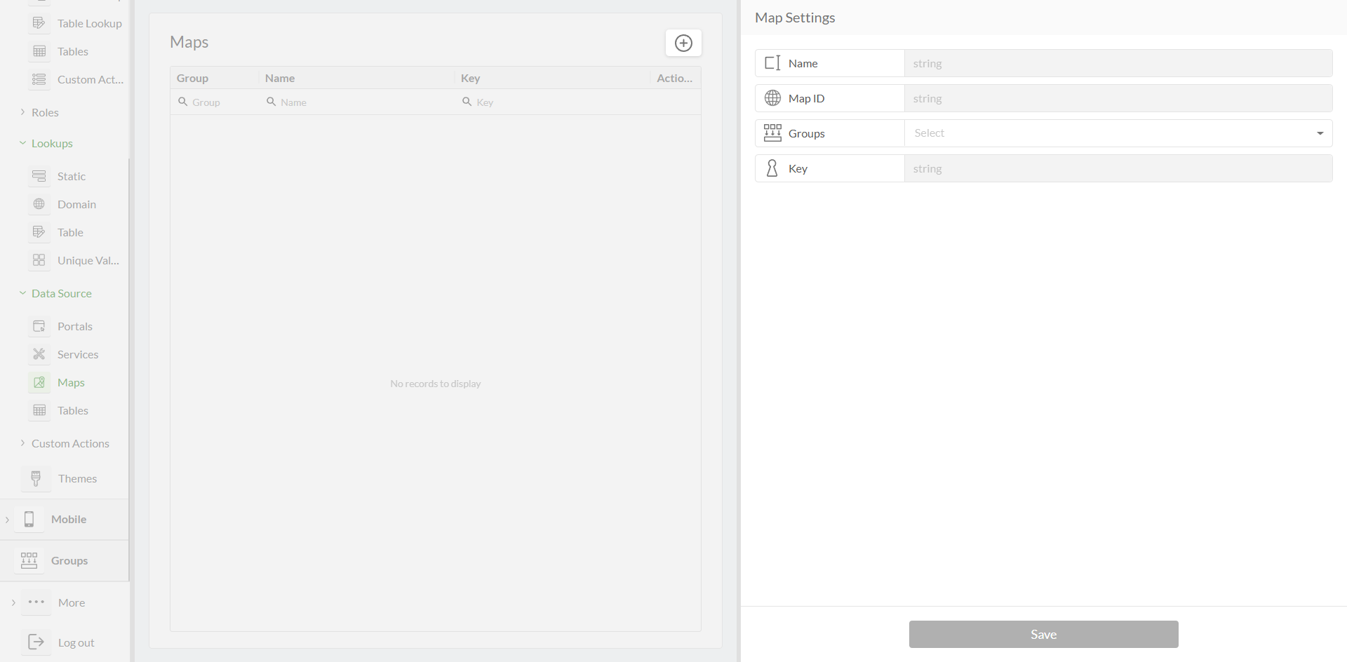
Map Settings
Option | Required? | Description | Visualization |
|---|---|---|---|
Name | Yes |
|
|
Key | Yes |
| |
Group | Yes |
| |
Map ID | Yes |
|
Tables page
Table (Feature Table) is an attribute table or attribute data, is a tabular representation of the attribute information associated with geographic features. Each row in the feature table corresponds to a single feature in the spatial dataset, and each column represents a specific attribute or characteristic of the features.
Actions on the Tables page:
Add a Table - manually or from the portal
Search a Table in the list of tables
View Table data - select columns, filter records, export
Manipulate Table data - add, edit, delete records
Edit Table settings
Delete a Table
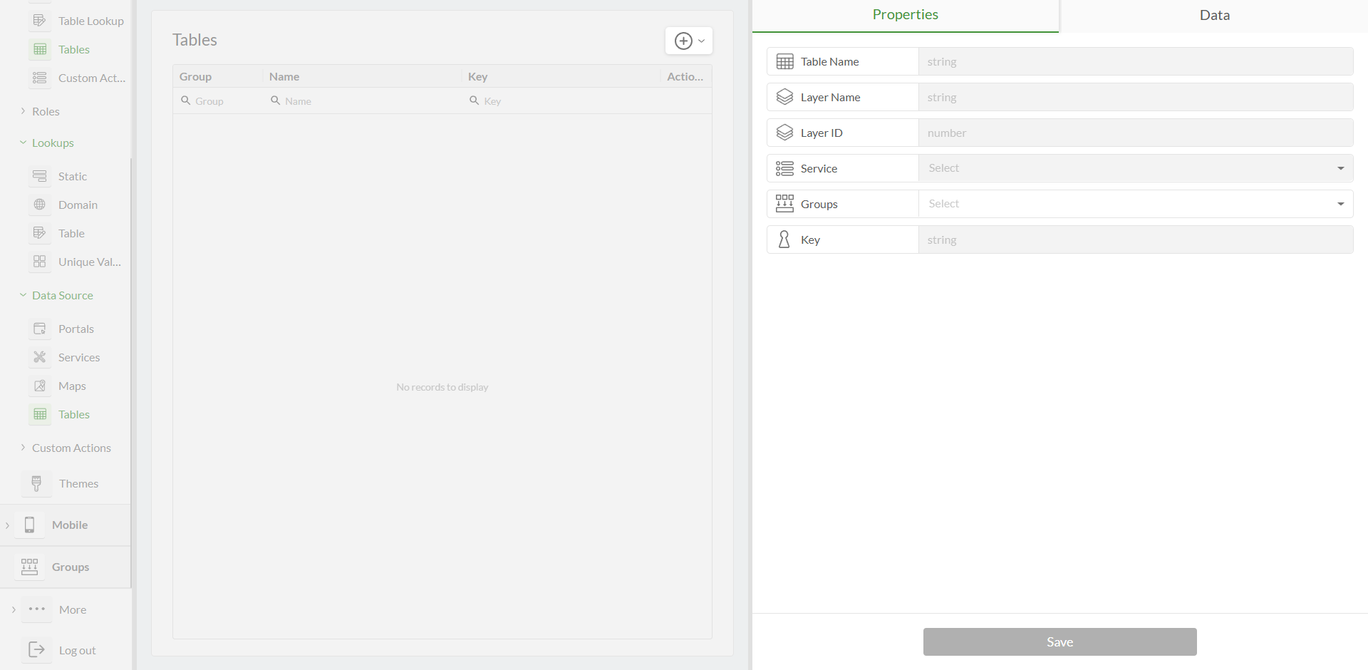
Table settings
Option | Required? | Description | Visualization |
|---|---|---|---|
Add a Table | Yes |
| |
Add a Table | Yes |
| |
Name | Yes |
| |
Key | Yes |
|
|
Group | Yes |
| |
Layer Name | Yes |
| |
Layer ID | Yes |
|
|
Services | Yes |
|
|


.png "Feature table - the example of multiple services(1).png")
Additional Options
Option | Description | Visualization |
|---|---|---|
Data Tab |
| |
Services |
|
|
Columns |
| |
Filters |
| |
Export |
| |
Add Record |
|
|
Edit Record |
|
|
Delete Record |
|


